Links
Here-below you can find some general information for different type of compasses.
What Is Compass ?
Compass is an instrument which points to the north. With it, we are able to hold to a desired direction either on land or at sea – or as a sailor might say “to steer a desired course”. Through every point of the earth’s surface run lines of force of the earth’s magnetic field.
The card or needle of a magnetic compass, which has been installed in an ironfree environment, orients itself in the direction of these magnetic lines of forces. In other words, the compass needle positions itself parallel to the magnetic north-south axis.
The point of the compass needle points to the magnetic North Pole. Around the turn of the century, the gyrocompass was developed. In this a “fettered gyrocompass”, the axis of which is held in a particular way, automatically oscillates parallel to the axis of the “great gyro” earth. The earth turns at a speed of 1,666 Km/h (measured at the equator).
On the compass card of the gyro compass, the direction of the vehicle is travelling can be read off in relation to geographical north.
The Magnetic Compass
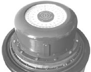
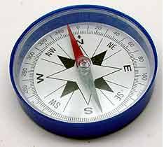 The oldest and, in its construction, simplest compass is the magnetic compass. It consists of a casing in which a magnet can rotate freely in a horizontal position. The magnet is either connected to a graduated disc known as the compass card or rose, or it is housed in a graduated sphere.
According to their types of construction, they are known as the flat compass and the spherical compass, respectively. The revolving system must be centered to ensure that it does not make contact with the casting.
Normally, a centering pin which is positioned on the magnet or sphere is used for this purpose. A liquid supports the revolving system, relieving the suspension and damping the movements of the compass card.
The card is thus steadied to ensure easy reading. The lines of forces of the earth’s magnetic field compel the compass magnet which is one “Pole” always to point to the north. The compass magnet is connected to the disc or sphere in such a way that the graduate index of the compass card orients itself in the “North” position. We can therefore read of “North” or “Course” at any time.
Nobody is perfect – not even the compass. This instrument does unfortunately make errors, and that is what we discuss next.
In navigation, we are interested in the geographical North Pole of the earth. However, the magnetic compass points to magnetic north. Unfortunately, these are not the same. In addition, the earth’s magnetic field is not so homogeneous everywhere that the magnetic compass will even point to magnetic north, all the time.
The errors originating from this source are known as “magnetic variation”. That is to say: the angle between the geographic meridian passing through a locality and the magnetic meridian at the same place.
Thank goodness sea charts indicate the magnitude of variation at the area where one actually is. If one doesn’t happen to have a sea chart with the laconic note: “Area with indefinite variation” in front of him, then the errors can be taken into consideration.
Westerly variation makes a compass read higher in degrees and easterly makes it read lower… do you remember? Compass roses are placed at various positions on the sea charts.
They are of great importance as they indicate the magnitude and direction of the variation, as well as the yearly changes for that particular area. Do not underestimate the variation: for example, high variations of more than 70Ί have been observed in the Bermuda area.
There is also a second error that must be corrected: the deviation. The iron masses of a ship or its cargo are themselves more ore less magnetic, and as such, influence the magnetic compass. The resulting errors vary according to the steered course because the line of force of the ship’s own magnetic field intersect those of the earth in difference directions. A compass adjuster tries to eliminate the influence of the ship’s field of force on the compass as far as possible by means of compensating procedures.
To do this, the ship is turned by 360Ί, and at various points bearing are taken to determine how great the deviation is on each particular course. The result is the famous Deviation Table. And now you can start calculating again: add for westerly errors, etc.
However, please don’t be too sure that you are absolutely correct! During winter lay up, or during periods when the vessel has been docked for a long time, a ship’s magnetic field may, under certain circumstances, build up, only to disappear again after the engine has been running far a while. Or: sailing yachts normally determine their deviation tables on an even keel…As soon as such a craft heels, the position of the vessel’s iron mass alters relative to the compass and the deviation table, so laboriously determined and compiled, probably is no longer correct!
Or: atmospheric influences, such as a thunderstorm, cause the vessel to become statically charged which, of course, influences the compass…
Nevertheless, most ships reach their destinations in spite of the short-coming of the magnetic compass. On the relatively sort trips which recreational boats usually make, the errors do not accumulate alarmingly. However, with larger yachts making longer voyages, these inaccuracies become more serious. One must navigate even more carefully and never forget that the reliability of each calculation depends on the accuracy of the instruments used. Knowledge of the limitations on accuracy, for example of a compass, is so important because above all the safety of the crew and the ship depend on it.
The Gyro Compass
 It started with a wild idea…. Towards the end of the 19th century a young art student inherited considerable wealth which enabled him to do the fashionable thing: to travel.
Hearing about the polar expeditions which were taking place at that time, he became interested in the North Pole. In 1901 he decided to try to reach the North Pole by means of a submarine in order to dispense with the long and arduous trek over the ice. He intended to travel from one ice-hole to the next under water. In order to achieve this, he needed a direction pointer which would help him to find the next ice-hole.
The magnetic compass could be ruled out. It wouldn’t function at the North Pole; and certainly not inside a submarine of steel mass. The problem of constructing this direction pointer became a life-long occupation.
Without a gyrocompass the modern standards of sea traffic would be unheard-of. Gyro devices made possible safe navigation in modern aviation as well as the techniques of rocket missile control. More than 90 years of technical development passed before it was possible to reduce the dimensions and power consumption of the gyrocompass in order to adapt it effectively to small boat navigation. As there are now yacht gyrocompasses available, all yachts-men should be familiar with the function of a gyro compass. They also should be aware of its advantages over the magnetic compass. A gyro, that is to say, a rapidly rotating body, endeavours to maintain its position in inertial space – this is a psychical law. Anyone attempting to defect this fixed axis of the gyro will be surprised to learn that the gyro will not tolerate this and will, in accordance with exact physically defined laws, take up a new position, but not the position one would expect. An everyday example can be seen by turning a bicycle upside dawn. Rotate the rear wheel at top speed with the pedals. Now try to lay the bicycle on its side. It will not tip over as you would perhaps suspect but will tumble over in an unusual way. The quality of the gyro to counteract attempts to change its rotation axis by moving in a particular direction is put to use in the gyrocompass.
The earth’s rotational axis and gravitational pull over allowed to influence the gyro so that when force is exerted, it changes its rotational axis to one parallel to the earth’s axis.
Dr. Anschutz was the first to use these physical principles constructively. The most difficult problem on the way to constructing a gyro compass for use on board ship was the task of eliminating additional acceleration caused through ship’s rolling and pitching. Anschutz’ cousin, the engineer Max Schuler, came to his aid in this matter. He magnificently complemented Dr. Anschutz, the genial designer, by lending theoretical genius to the cause. It was Max Schuler who recommended coupling two gyros to each other in such a way as to counteract the gyros’ evading motion induced by additional accelerations. Furthermore. Schuler discovered that a gyro system settles like a pendulum in the direction of north and does not react to any course or speed changes if the period of oscillation is 84.4 minutes – a natural law which by the way, holds true for all pendula and has gone down in the science of oscillations as Schuler tuning.
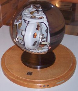
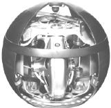
The two-gyro spherical compass. This principle developed by Anschutz forms the basis of all modern gyrocompasses: the north-indicating gyro system is hermetically sealed and accommodated in a hydrogen-filled sphere witch floats in a supporting liquid virtually free of friction. Following a suggestion made by Albert Einstein, a friend of Anschutz, the sphere was centered by means of an electromagnetic eddy current.
The alternating current required for the drive system is transmitted through the conductive liquid.
Anschutz’ Gyrocompass History
First gyroscopic direction-keeping instrument
1904/ 1905
Dr. Hermann Anschutz-Kaempfer granted a patent for his first gyroscopic direction-keeping instrument, the  “gyroscope”
1905: Anschutz & cO. founded in Kiel.
1909/12/14
The first automatic plotting table which, when linked with the compass and a log, automatically indicates the ship’s precise position.
Alexander Behn begins the development of echo sounder at Anschutz & Co, Kiel
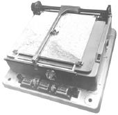
First automatic plotting table
1911 – Anschutz is granted for the patent of the three-gyro compass.
Manufacture of the first three-gyro compass. Anschutz receives large-scale orders from the imperial German Navy and the rest of the World.
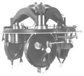
Manufacture of the first three-gyro compass
1916/20
The first artificial horizon and the first rate of turn indicator based upon the gyroscope principle of air navigation.
Anschutz delivers the first automatic pilot system, the so-called “Iron Helmsman”. At the same time the course recorded is introduced.
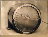
First artificial horizon
1925/26
Introduction of the two-gyro spherical compass.
Introduction of the two-gyro spherical compass
1928
The bi-directional compass. A further development of the spherical compass results in a device which, in addition to the azimuth, also provides the elevation, (roll/pitch).
Development of the gyro compass incorporating an automatic pilot system for the flight of the airship “Graf Zeppelin”.
1929/30
Carl Zeiss, Jena takes over the majority participations of Anschutz “ Co.
Dr. Hermann Anschutz-Kaempfe dies.
1935/36
The directional gyro. A precision directional gyro compass for aviation.
1938/43
Raytheon supports England referring to the development of the radar. Raytheon Marine will be founded.
Raytheon presents the first commercial radar unit. “it has ofen been said that the atomic bomb ended World War Two, but radar won it.”
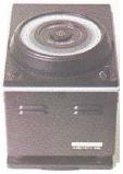
Two-gyrocompass Junior/Standard 4
1954/55
The beginning of production of the two-gyrocompass Junior/Standard 4
1956
Delivery of the newly developed COMPILOT 1, a combination of gyro compass and automatic pilot equipment for bridge installation.
1962/64
A precision directional gyro for land vehicles and sea-going vessels.
An electronically erected vertical gyro operating at high precision and having a long useful life for the field of sea gravimetry (research and surveying vessels) and for ship fire control systems.
1968
ZRK two-degree-of-freedom Gyro a space fixed position reference for biaxial stabilixing systems.
Little Gyrosphere.
Proven technology is applied. The north-indicating element as two-gyro system – with the well-known Schuler-Tuning of 84.4 minutes 0 in a hermetically sealed sphere with a diameter of only 115 mm.
Gyro Compass Standard 6 Compact
Gyro Compass Standard 6 Compact.
Anschutz supplements its standard series with a miniature gyro compass of a very compact, space-saving design.
1971
Electrically erected horizon system is made up of a vertical gyro and a gyro amplifier that controls the vertical position of the spin axis of the gyro.
First electronic autopilot for desk and bulkhead mounting.
1974/75
Anschutz merges with Zeiss Ikon Kiel.
Introduction of the first path guidance system – NAUTMAT
1976/78
Rate gyro for inland waterway navigation for early recognition of turning speed and direction of turn. Reference transmitter for the Anschutz river pilot – RIVERMAT
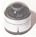
Miniature gyrocompass Standard 10
Miniature gyrocompass Standard 10 for sport purposes
1980
Standard 12 – the first gyrocompass for ships of all types and sizes.
1983
Serial production of gyrocompass Standard 14/ Gyrostar begins. Makes use of the most modern technology and production methods.
Three axis stabilized platform (GHS). A horizon reference system used in conjunction with Anschutz gyrocompass Std 4s
1984
Introduction of the product line NAUTOCONTROL.
NAUTOYACHT a navigation system in favour of demanding yachts.
1989
The Global Positioning System GPS revolutionizes the point of destination.
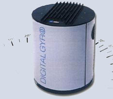
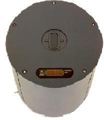
Digital Gyro Compass Standard 20
Digital Gyro Compass Standard 20.
Reliability, sophisticated technology and optimal cost/ performance ration make Anschutz gyrocompass systems world class products in global market.
1995
The Pathfinder/ST MK2 is the 2nd generation of superior Technology IMO radars that have proved to be unmatched in performance, user acceptance and reliability.
1996/98
Carl Zeiss sells the navigation and cinema products of the Anschutz company to Raytheon USA, it is now called Raytheon Anschutz GmbH and sells radar and communication systems in addition.
Raytheon Anschutz purchases Standard Radio Sweden. A company developing and producing ship’s communication systems.
The electronic sea chart (ECDIS) comes to existence.
Nautopilot NP2000 series
– For ships from 10 to 60 m length.
– Best course keeping performance.
– At low and high speed up to 70 knots (IMO-HSC)
– Suitable for any hull type: monohull, catamaran
2000/2001
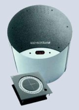
Gyrostar 2 system
Gyrostar 2 system a further technical development of the Standard 20. The equipment consists of compass, steering repeater and autopilot.
2002
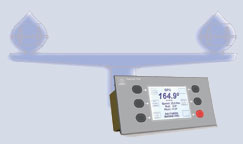
Digital Gyro Compass Standard 22
DigitalGyro Compass Standard 22, slip-ring-free power transmission smallest dynamic error through patented course-reading – increased operational safety and high accuracy of the north-seeking function combined with excellent reliability.
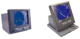
NSC Radar System
Insertion of the NSC Radar System based on PC technology.
2005
The new Anschutz Satellite Compass for small ships uses GPS signals to produce ship’s heading information. It can be used as a compass sensor for repeaters, radars electronic chart system, AIS, scanning sonar and TV antennas.
Latest Technologies – With the new NSC 18, NSC 25 and NSC 34 radars.
The new Anschutz Satellite Compass
Raytheon presents one of the most sensitive radars even under rough weather conditions. Brilliant performance goes hand in hand with ease of use and installation. The new NSC radar, which is manufactured in Kiel, Germany, is an excellent solution not only for single radar installations but also as part of integrated Bridge Systems.